1
/
de
1
mysite
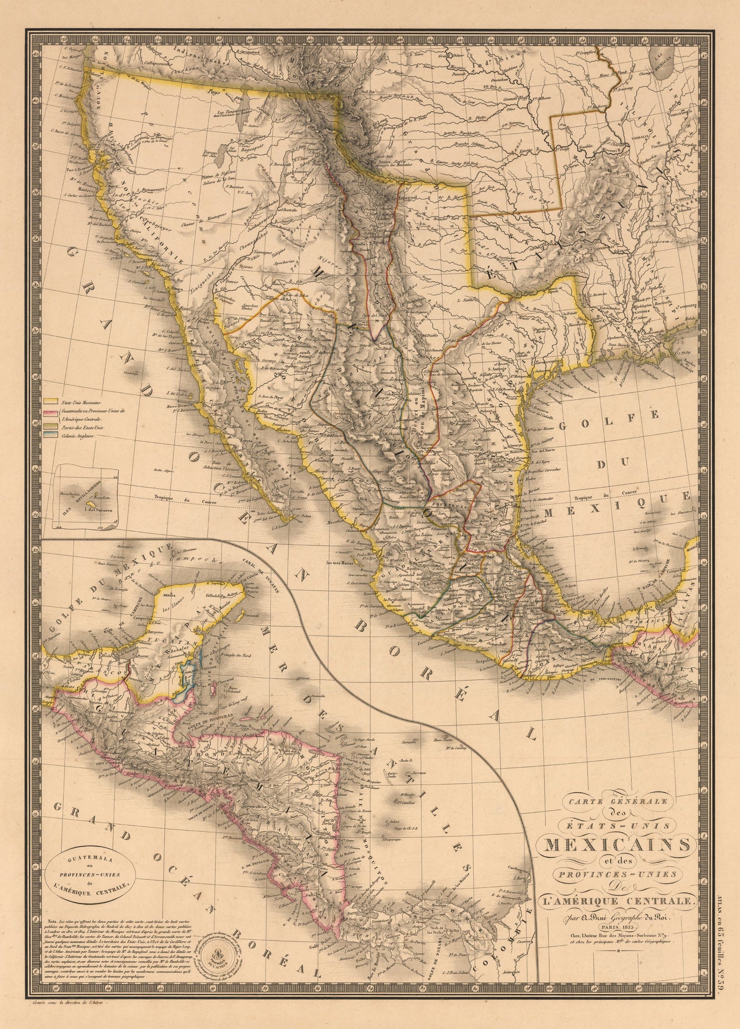
1826 Carte Generale des Etats Unis Mexicains et des Provinces-Unies De L¡¯Amerique Centrale
1826 Carte Generale des Etats Unis Mexicains et des Provinces-Unies De L¡¯Amerique Centrale
Prix habituel
369,00 NOK
Prix habituel
374,00 NOK
Prix promotionnel
369,00 NOK
Taxes incluses.
Frais d'expédition calculés à l'étape de paiement.
By: Adrien Hubert Brue
Date: 1826 (Published) Paris
Dimensions: 20.25 x 14.5 inches (51.44 x 36.8 cm)
The map Carte Generale des Etats-Unis Mexicains et des Provinces-Unies de l'Amerique Centrale shows Mexico in possession of California, the Southwest, and Texas, which is named, but not yet delineated. The topography is represented in hachure and is based on the expeditions of Lewis and Clark, Pike and Long. All river systems of the area and their tributaries are depicted. An inset in the lower left quadrant is entitled Guatemala ou Provinces-Unis de l'Amerique Centrale, and covers Central America and the Yucatan peninsula.
Adrien-Hubert Brue (1786 - 1832) was a French cartographer active in the late 18th and early 19th centuries. He held the office of Geographe du Roi and often signed his maps as such. In this position Brue contributed to thousands of maps and numerous atlases. His maps are known for their beauty, their clarity and accuracy. Like most cartographers many of his maps were published posthumously. Many of his maps were published posthumously by his partner, Charles Picquet's son and heir, Pierre-Jacques Picquet, and were still being updated and republished decades after his death.
Inventory #10997
Quantité
Impossible de charger la disponibilité du service de retrait
Share