mysite
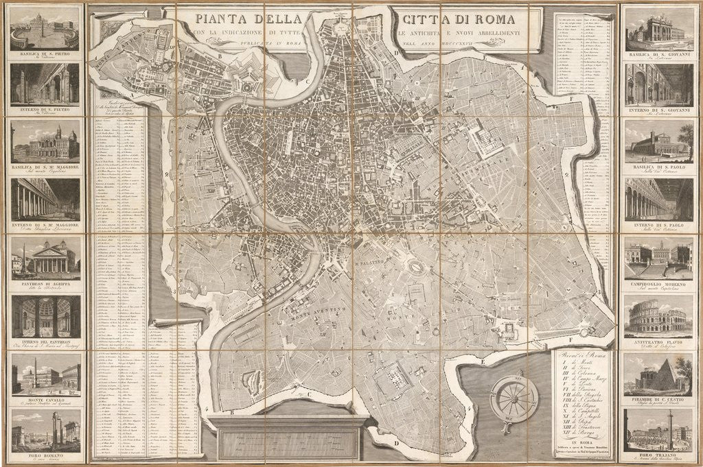
1827 Pianta della Citta di Roma con la Indicazione di Tutte
1827 Pianta della Citta di Roma con la Indicazione di Tutte
By: Pietro Ruga
Date: 1827 (Published) Rome
Original Size: 29.5 x 44 inches (75 cm x 112 cm)
This is a reproduction of an impressive folding traveler's map of Rome. The original map was published by Pietro Ruga out of Romer in 1827
The map provides a remarkable bird¡¯s eye view of Rome and its immediate environs, including Vatican City. For anyone who has been to Rome, it¡¯s easy to see that the streets have not changed, that one could use this map even today, for it enumerates Rome¡¯s regions with Roman numerals following which they are named, and it includes a comprehensive coded list of the major monuments of the city.
Flanking the map on either side are engravings of the most famous of Rome¡¯s landmarks including The Pyramid of Cestius, the Colosseum, the Pantheon of Agrippa (completed and dedicated by Hadrian), and Trajan¡¯s Column, to name a few. A large compass rose orients the map ever so slightly to the northeast.
Inventory #10753
Impossible de charger la disponibilité du service de retrait
Share