mysite
1740 Mappa Geographica, complectens I. Indiae Occidentalem II. Isthmum Panamensem...
1740 Mappa Geographica, complectens I. Indiae Occidentalem II. Isthmum Panamensem...
Cena regularna
369,00 NOK
Cena regularna
374,00 NOK
Cena promocyjna
369,00 NOK
Z wliczonymi podatkami.
Koszt wysyłki obliczony przy realizacji zakupu.
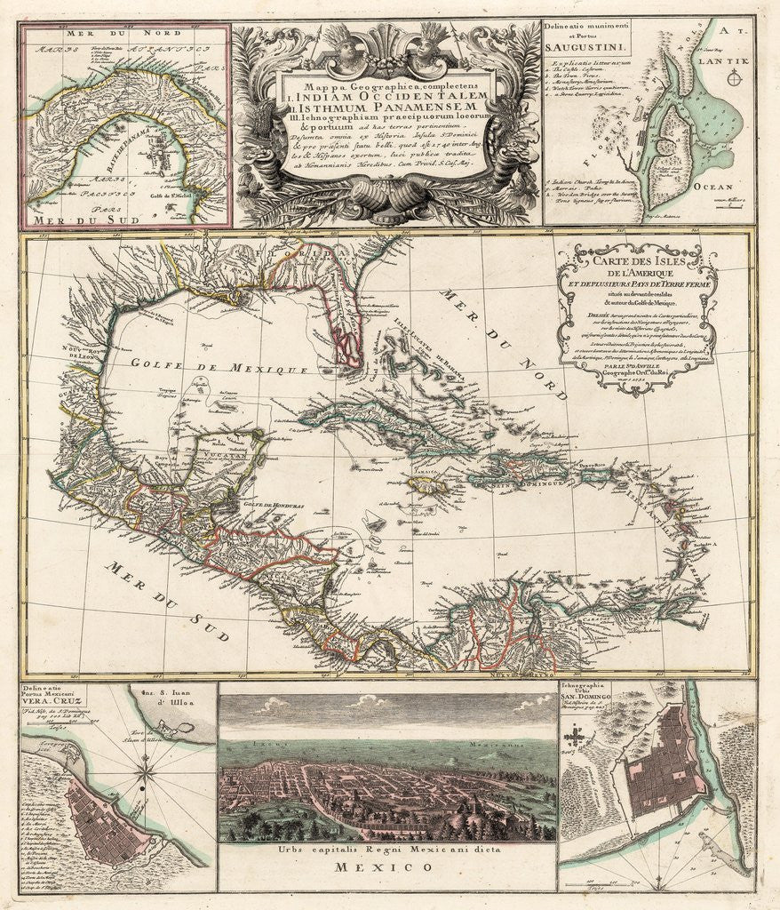
Mappa Geographica, complectens I. Indiae Occidentalem II. Isthmum Panamensem III. Ichnographiam praecipurorum locorum & portuum as has terras pertinentium
By: Homann Heirs
Date: 1740 (circa) Nuremberg
Original Size: 22.75 x 19 inches (57.8 x 48.5 cm)
This is a reproduction of an authentic antique map of the Caribbean with several smaller inserts surrounding, by Homann Heirs. The map was published in Nuremberg circa 1740.
This exciting?copper-plate engraving focuses on the Caribbean, showing portions of North, Central, and South America. The large central map is titled Carte de Isles de l¡¯Amerique et Deplusieurs Pays Terre Ferme,¡± and credits D¡¯Anville for the cartography. The map is color coded showing European possessions throughout the area. The main map is surrounded by 5 smaller insert maps that include the Isthmus of Panama, one of the earliest obtainable plans of St. Augustine, a bird¡¯s eye view of Mexico City, and plans of Vera Cruz and San Domingo.
Inventory #18910
Ilość
Nie można załadować gotowości do odbioru
Share